
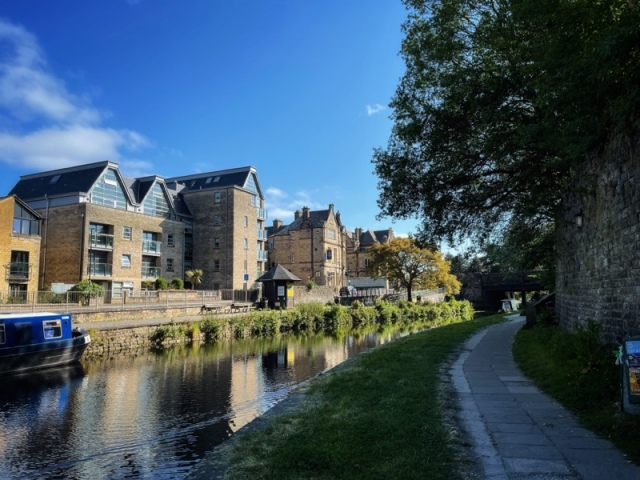
Just down from the extensive Royal Lancaster Infirmary (RLI), and passing under the busy A6 road from the south, there begins one of the most attractive sections of the old Lancaster Canal, as it leaves behind the gentle countryside of north Lancashire and enters the old industrial landscape of the former ‘county town’ from which the county name derives.

The House of Lancaster features prominently in English history, alongside its old rival the House of York. The historically-famous Wars of the Roses were fought between these great dynastic powers, though much of the action was in the south of England. Shakespeare’s ‘history plays’ are rich with references.
My wife had a routine appointment at the RLI hospital and we decided to make a morning of it, planning to stroll around the city centre in the beautiful May sunshine.

But first the dog needed her walk… I left Bernie at the hospital and we headed to the edge of the city. The old canal path offered an obvious route for a dog walk, taking in banks of grass as well as the hard standing of most of the track.

Though we had walked other sections – the canal stretches, lock-free from Preston to Tewitfield near Carnforth – I had never explored this part, which is local to the city centre in Lancaster. The beautiful day, full of May freshness, enabled an enchanting hour of strolling and letting Tess sample a million new sniffs…

The Aldcliffe district of Lancaster now opens up on the right hand side of the opposite path. This follows the line of the canal down towards Glasson Dock – and the sea.

Beyond the Aldcliffe Bridge, the landscape ‘softens’ as it curls to follow the estuary of the River Lune.


We didn’t get much further. The phone rang. My wife’s appointment had finished early. Tess and I needed to turn round to rejoin her in the city centre.
On another occasion, I hope to continue this walk – and record it on a similarly perfect day.

©Stephen Tanham 2023
Stephen Tanham is a Director of the Silent Eye, a journey through the forest of personality to the dawn of Being.
http://www.thesilenteye.co.uk and http://www.suningemini.blog
I do love canal walks, even though they were man-made, they are a beautiful part of the countryside…
I share that, Jaye! After all, half our back garden used to be one! Thank you 😊
💕
Perfect weather for a gorgeous walk. I love the canal vistas!
Thank you, Noelle. The weather has been very kind 😀